Problem
This problem was taken from Module 3: Exercise 2, Advanced Queries to Get Information. This example asks the user to perform several different types of queries in order to obtain information on schools located in the 907 and 909 watersheds.
Analysis Procedures
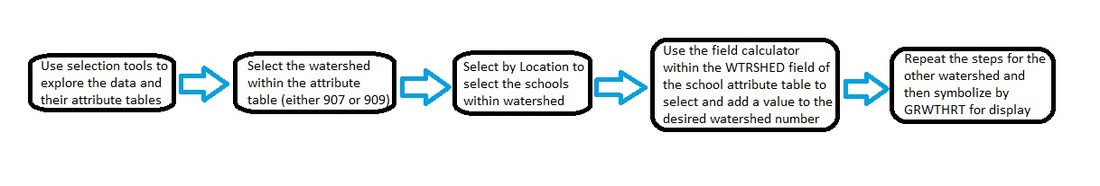
The problem starts with the exploration of the data by creating simple queries, such as select by attributes and select by location for the land use data by watershed. Then a graph was created of the queries to allow for a visual comparison of the data (Results #1). This same process was followed by the use of the select by attributes and select by location tool within the census layer by watershed. A graph of the 1990 and 2000 Comparison is created from the top View menu. The next step was to open the attribute table of the Census layers tract and calculate the GRWTH_RT field using the field calculator and the given query equation. The census tracts were then symbolized by GRWTH_RT with 6 break values. The schools for each watershed were then assigned the codes of 909 and 907 through a query depending on location. Lastly, the symbology was then changed for the each school type falling within the two watersheds (Results #2).
Model:
Results
Result #1: Example of selection query using the watershed attribute 907 and it's resulting graph for interpretation. As seen in the graph, the land use code 2 (single family) is the dominating attribute.

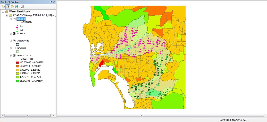
Result #2: Final display of selected schools falling completely within and categorized by watershed. The user can compare the totals of each water shed and find that the schools are almost equal in quantity.
Certificate:

Application & Reflection
This module uses several different query methods such as select by attributes, select by location, field calculator, graphs and symbology to produce informative results. These comparisons of watershed, land use, and schools could now be combined for a reliable report if needed. I can see how these advanced skills in query, selection, and presentation of symbology could be applied to a number of real life situations. Personally, I can see the use of these methods being used for city improvement planning based queries for street repair locations within zip codes and areas of high activity.
